
- This event has passed.
248-NASA – The Bedrock Beneath – ICESat Satellite
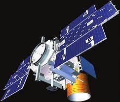
The ICESat mission will provide multi-year elevation data needed to determine ice sheet mass balance as well as cloud property information, especially for stratospheric clouds common over polar areas. It will also provide topography and vegetation data around the globe, in addition to the polar-specific coverage over the Greenland and Antarctic ice sheets.
Our understanding of what lies beneath the world’s biggest ice sheet has taken another leap forward. In this video we strip away Antarctic ice to reveal a new, and much more detailed map of the bedrock below. This map, called Bedmap2, was compiled by the British Antarctic Survey and incorporates millions of new measurements, including substantial data sets from NASA’s ICESat satellite and an airborne mission called Operation IceBridge.
https://icesat.gsfc.nasa.gov/icesat/docs/ICESat_Litho6-1.pdf